
 loading weather ...


At this moment the current water temperature in Brighton is -. The average water temperature in Brighton today is -.
The effects of Water Temperature
Fish are cold blooded, which means their metabolism is strongly influenced by the temperature of their surrounding environment. Fish want to stay comfortable. Consequently, even a small change or break will cause fish to move from one location to another.
In general, this behavior varies for each species and place, so we can not specify an ideal water temperature, however as a general rule we will try to avoid the temperatures abnormally cold in summer and too warm in winter. Remember, look for the comfort zones and you will find the fish.


We consider the waves in the open sea.
The waves you will find on the shore can be slightly affected by the orientation of the coastline and the seabed of the beaches, although in most cases they are usually equivalent.
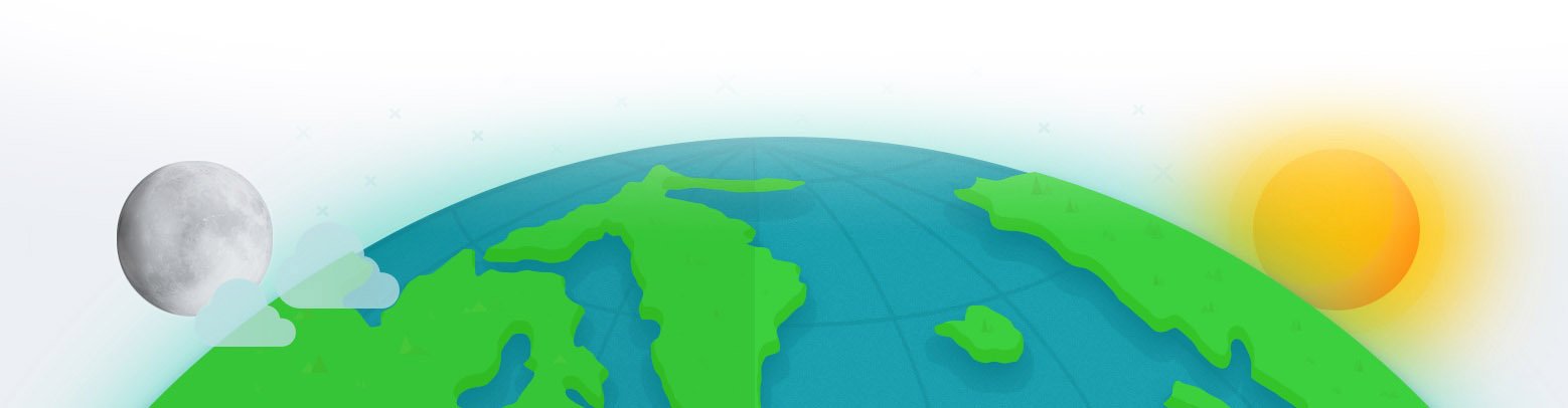
Today Saturday, 27th of April of 2024, the sun rose in Brighton at 6:47:19 am and sunset will be at 5:39:02 pm. In the high tide and low tide chart, we can see that the first low tide was at 12:03 am and the next low tide at 11:25 am. The first high tide was at 5:47 am and the next high tide will be at 5:56 pm.
Today we have 10 hours and 51 minutes of sun. The solar transit was at 12:13:10 pm.


The tidal coefficient today is 68 (average). At noon the tidal coefficient drops to 63. The day ends with a tidal coefficient of 58.
We can compare these levels with the maximum high tide recorded in the tide tables for Brighton which is of 2.5 m and a minimum height of 0.0 m.


The following graph shows the progression of the tidal coefficient in the month of April of 2024.These values give us a rough idea of the tidal amplitude in Brighton, forecast in April.
Large coefficients indicate important high and low tides; major currents and movements usually take place on the sea bed. But bear in mind that this tidal amplitude may be greatly affected by the weather and you should also consult the weather forecast in Brighton, the wind in Brighton and the surf forecast in Brighton before you go fishing.


 April, 2024 |
||||||||
| DAY | TIDES FOR BRIGHTON | SOLUNAR ACTIVITY | ||||||
| 1st TIDE | 2nd TIDE | 3rd TIDE | 4th TIDE | COEFFICIENT | SOLUNAR ACTIVITY | |||
1
Mon |
7:26 am
7:11 pm |
2:39 am
0.4 m |
7:53 am
1.2 m |
1:26 pm
0.3 m |
8:25 pm
2.0 m |
37
low
|
||
2
Tue |
7:27 am
7:10 pm |
3:11 am
0.6 m |
7:42 am
1.0 m |
1:19 pm
0.4 m |
8:43 pm
1.8 m |
35
low
|
||
3
Wed |
7:28 am
7:09 pm |
4:05 am
0.9 m |
6:06 am
1.0 m |
12:38 pm
0.5 m |
8:40 pm
1.6 m |
45
low
|
||
4
Thu |
7:29 am
7:07 pm |
11:28 am
0.5 m |
7:06 pm
1.4 m |
10:51 pm
1.3 m |
61
average
|
|||
5
Fri |
7:29 am
7:06 pm |
4:06 am
1.6 m |
11:11 am
0.4 m |
5:56 pm
1.5 m |
10:49 pm
1.0 m |
80
high
|
||
6
Sat |
7:30 am
7:05 pm |
4:41 am
1.8 m |
11:18 am
0.4 m |
5:41 pm
1.7 m |
11:09 pm
0.8 m |
96
very high
|
||
7
Sun |
7:31 am
6:03 pm |
5:11 am
2.0 m |
11:30 am
0.3 m |
4:44 pm
1.9 m |
10:33 pm
0.5 m |
108
very high
|
||
8
Mon |
6:32 am
6:02 pm |
4:37 am
2.1 m |
10:43 am
0.3 m |
4:55 pm
2.1 m |
10:58 pm
0.3 m |
113
very high
|
||
9
Tue |
6:33 am
6:01 pm |
4:59 am
2.0 m |
10:56 am
0.3 m |
5:09 pm
2.3 m |
11:22 pm
0.2 m |
111
very high
|
||
10
Wed |
6:33 am
5:59 pm |
5:19 am
1.9 m |
11:07 am
0.3 m |
5:25 pm
2.4 m |
11:46 pm
0.1 m |
102
very high
|
||
11
Thu |
6:34 am
5:58 pm |
5:36 am
1.8 m |
11:17 am
0.2 m |
5:42 pm
2.4 m |
88
high
|
|||
12
Fri |
6:35 am
5:57 pm |
12:09 am
0.1 m |
5:50 am
1.6 m |
11:29 am
0.1 m |
6:02 pm
2.4 m |
71
high
|
||
13
Sat |
6:36 am
5:55 pm |
12:31 am
0.2 m |
6:03 am
1.5 m |
11:42 am
0.1 m |
6:23 pm
2.3 m |
54
average
|
||
14
Sun |
6:37 am
5:54 pm |
12:54 am
0.3 m |
6:15 am
1.4 m |
11:56 am
0.1 m |
6:45 pm
2.2 m |
40
low
|
||
15
Mon |
6:37 am
5:53 pm |
1:17 am
0.5 m |
6:25 am
1.3 m |
12:08 pm
0.2 m |
7:07 pm
2.1 m |
32
low
|
||
16
Tue |
6:38 am
5:52 pm |
1:41 am
0.7 m |
6:29 am
1.2 m |
12:16 pm
0.4 m |
7:28 pm
1.9 m |
33
low
|
||
17
Wed |
6:39 am
5:50 pm |
2:09 am
0.9 m |
6:07 am
1.1 m |
12:06 pm
0.6 m |
7:38 pm
1.7 m |
40
low
|
||
18
Thu |
6:40 am
5:49 pm |
10:54 am
0.8 m |
6:39 pm
1.5 m |
11:11 pm
1.4 m |
51
average
|
|||
19
Fri |
6:40 am
5:48 pm |
2:30 am
1.5 m |
9:39 am
0.8 m |
4:39 pm
1.5 m |
9:31 pm
1.2 m |
61
average
|
||
20
Sat |
6:41 am
5:47 pm |
3:05 am
1.6 m |
9:35 am
0.7 m |
4:09 pm
1.8 m |
9:45 pm
1.0 m |
70
high
|
||
21
Sun |
6:42 am
5:45 pm |
3:31 am
1.8 m |
9:46 am
0.6 m |
4:12 pm
2.0 m |
10:05 pm
0.8 m |
77
high
|
||
22
Mon |
6:43 am
5:44 pm |
3:55 am
1.9 m |
10:01 am
0.5 m |
4:23 pm
2.2 m |
10:27 pm
0.6 m |
82
high
|
||
23
Tue |
6:44 am
5:43 pm |
4:18 am
2.0 m |
10:18 am
0.4 m |
4:38 pm
2.3 m |
10:49 pm
0.4 m |
84
high
|
||
24
Wed |
6:44 am
5:42 pm |
4:41 am
2.0 m |
10:35 am
0.3 m |
4:55 pm
2.4 m |
11:12 pm
0.3 m |
84
high
|
||
25
Thu |
6:45 am
5:41 pm |
5:03 am
1.9 m |
10:52 am
0.2 m |
5:13 pm
2.4 m |
11:37 pm
0.2 m |
81
high
|
||
26
Fri |
6:46 am
5:40 pm |
5:25 am
1.8 m |
11:08 am
0.2 m |
5:33 pm
2.4 m |
76
high
|
|||
27
Sat |
6:47 am
5:39 pm |
12:03 am
0.1 m |
5:47 am
1.6 m |
11:25 am
0.2 m |
5:56 pm
2.4 m |
68
average
|
||
28
Sun |
6:48 am
5:37 pm |
12:31 am
0.2 m |
6:10 am
1.5 m |
11:42 am
0.2 m |
6:21 pm
2.3 m |
58
average
|
||
29
Mon |
6:48 am
5:36 pm |
1:01 am
0.3 m |
6:31 am
1.3 m |
11:57 am
0.3 m |
6:47 pm
2.2 m |
49
low
|
||
30
Tue |
6:49 am
5:35 pm |
1:36 am
0.5 m |
6:47 am
1.1 m |
12:07 pm
0.4 m |
7:15 pm
2.0 m |
42
low
|
||
| April, 2024 |
||||
| DAY | TIDES FOR BRIGHTON | |||
| 1st TIDE | 2nd TIDE | 3rd TIDE | 4th TIDE | SOLUNAR ACTIVITY |
1
Mon |
2:39 am
0.4 m |
7:53 am
1.2 m |
1:26 pm
0.3 m |
8:25 pm
2.0 m |
2
Tue |
3:11 am
0.6 m |
7:42 am
1.0 m |
1:19 pm
0.4 m |
8:43 pm
1.8 m |
3
Wed |
4:05 am
0.9 m |
6:06 am
1.0 m |
12:38 pm
0.5 m |
8:40 pm
1.6 m |
4
Thu |
11:28 am
0.5 m |
7:06 pm
1.4 m |
10:51 pm
1.3 m |
|
5
Fri |
4:06 am
1.6 m |
11:11 am
0.4 m |
5:56 pm
1.5 m |
10:49 pm
1.0 m |
6
Sat |
4:41 am
1.8 m |
11:18 am
0.4 m |
5:41 pm
1.7 m |
11:09 pm
0.8 m |
7
Sun |
5:11 am
2.0 m |
11:30 am
0.3 m |
4:44 pm
1.9 m |
10:33 pm
0.5 m |
8
Mon |
4:37 am
2.1 m |
10:43 am
0.3 m |
4:55 pm
2.1 m |
10:58 pm
0.3 m |
9
Tue |
4:59 am
2.0 m |
10:56 am
0.3 m |
5:09 pm
2.3 m |
11:22 pm
0.2 m |
10
Wed |
5:19 am
1.9 m |
11:07 am
0.3 m |
5:25 pm
2.4 m |
11:46 pm
0.1 m |
11
Thu |
5:36 am
1.8 m |
11:17 am
0.2 m |
5:42 pm
2.4 m |
|
12
Fri |
12:09 am
0.1 m |
5:50 am
1.6 m |
11:29 am
0.1 m |
6:02 pm
2.4 m |
13
Sat |
12:31 am
0.2 m |
6:03 am
1.5 m |
11:42 am
0.1 m |
6:23 pm
2.3 m |
14
Sun |
12:54 am
0.3 m |
6:15 am
1.4 m |
11:56 am
0.1 m |
6:45 pm
2.2 m |
15
Mon |
1:17 am
0.5 m |
6:25 am
1.3 m |
12:08 pm
0.2 m |
7:07 pm
2.1 m |
16
Tue |
1:41 am
0.7 m |
6:29 am
1.2 m |
12:16 pm
0.4 m |
7:28 pm
1.9 m |
17
Wed |
2:09 am
0.9 m |
6:07 am
1.1 m |
12:06 pm
0.6 m |
7:38 pm
1.7 m |
18
Thu |
10:54 am
0.8 m |
6:39 pm
1.5 m |
11:11 pm
1.4 m |
|
19
Fri |
2:30 am
1.5 m |
9:39 am
0.8 m |
4:39 pm
1.5 m |
9:31 pm
1.2 m |
20
Sat |
3:05 am
1.6 m |
9:35 am
0.7 m |
4:09 pm
1.8 m |
9:45 pm
1.0 m |
21
Sun |
3:31 am
1.8 m |
9:46 am
0.6 m |
4:12 pm
2.0 m |
10:05 pm
0.8 m |
22
Mon |
3:55 am
1.9 m |
10:01 am
0.5 m |
4:23 pm
2.2 m |
10:27 pm
0.6 m |
23
Tue |
4:18 am
2.0 m |
10:18 am
0.4 m |
4:38 pm
2.3 m |
10:49 pm
0.4 m |
24
Wed |
4:41 am
2.0 m |
10:35 am
0.3 m |
4:55 pm
2.4 m |
11:12 pm
0.3 m |
25
Thu |
5:03 am
1.9 m |
10:52 am
0.2 m |
5:13 pm
2.4 m |
11:37 pm
0.2 m |
26
Fri |
5:25 am
1.8 m |
11:08 am
0.2 m |
5:33 pm
2.4 m |
|
27
Sat |
12:03 am
0.1 m |
5:47 am
1.6 m |
11:25 am
0.2 m |
5:56 pm
2.4 m |
28
Sun |
12:31 am
0.2 m |
6:10 am
1.5 m |
11:42 am
0.2 m |
6:21 pm
2.3 m |
29
Mon |
1:01 am
0.3 m |
6:31 am
1.3 m |
11:57 am
0.3 m |
6:47 pm
2.2 m |
30
Tue |
1:36 am
0.5 m |
6:47 am
1.1 m |
12:07 pm
0.4 m |
7:15 pm
2.0 m |
| April, 2024 |
||||
| DAY | COEFFICIENT | SOLUNAR ACTIVITY | ||
1
Mon |
7:26 am
7:11 pm |
37
low
|
||
2
Tue |
7:27 am
7:10 pm |
35
low
|
||
3
Wed |
7:28 am
7:09 pm |
45
low
|
||
4
Thu |
7:29 am
7:07 pm |
61
average
|
||
5
Fri |
7:29 am
7:06 pm |
80
high
|
||
6
Sat |
7:30 am
7:05 pm |
96
very high
|
||
7
Sun |
7:31 am
6:03 pm |
108
very high
|
||
8
Mon |
6:32 am
6:02 pm |
113
very high
|
||
9
Tue |
6:33 am
6:01 pm |
111
very high
|
||
10
Wed |
6:33 am
5:59 pm |
102
very high
|
||
11
Thu |
6:34 am
5:58 pm |
88
high
|
||
12
Fri |
6:35 am
5:57 pm |
71
high
|
||
13
Sat |
6:36 am
5:55 pm |
54
average
|
||
14
Sun |
6:37 am
5:54 pm |
40
low
|
||
15
Mon |
6:37 am
5:53 pm |
32
low
|
||
16
Tue |
6:38 am
5:52 pm |
33
low
|
||
17
Wed |
6:39 am
5:50 pm |
40
low
|
||
18
Thu |
6:40 am
5:49 pm |
51
average
|
||
19
Fri |
6:40 am
5:48 pm |
61
average
|
||
20
Sat |
6:41 am
5:47 pm |
70
high
|
||
21
Sun |
6:42 am
5:45 pm |
77
high
|
||
22
Mon |
6:43 am
5:44 pm |
82
high
|
||
23
Tue |
6:44 am
5:43 pm |
84
high
|
||
24
Wed |
6:44 am
5:42 pm |
84
high
|
||
25
Thu |
6:45 am
5:41 pm |
81
high
|
||
26
Fri |
6:46 am
5:40 pm |
76
high
|
||
27
Sat |
6:47 am
5:39 pm |
68
average
|
||
28
Sun |
6:48 am
5:37 pm |
58
average
|
||
29
Mon |
6:48 am
5:36 pm |
49
low
|
||
30
Tue |
6:49 am
5:35 pm |
42
low
|
||
The moon set at 9:55 am at 237° southwest. Eventually, the moon will rise again in the southeast (124°) at 7:30 pm.


When the solunar period coincides with sunrise or sunset, we can expect more activity than initially planned. These peak periods are reflected in green. We additionally point out in the chart the periods of greatest activity during the year with a big blue fish on the period bar + info

Adelaide (Outer Harbour) | American River | Ardrossan | Arno Bay | Baird Bay | Balgowan | Baroota | Beachport | Blackfellows Caves | Bluff Beach | Bookabie | Boston | Brentwood | Brighton | Canunda | Cape Borda | Cape Douglas | Cape Elizabeth | Cape Jaffa | Cape Jervis | Carpenter Rocks | Charra | Coffin Bay | Colton | Coorabie | Corny Point | Coulta | Cowell | Cowleds Landing | Deepwater | Eba Anchorage | Edithburgh | Eight Mile Creek | Elliston | Emu Bay | Encounter Bay | Fisherman Bay | Flinders Chase | Foul Bay | Fowlers Bay | German Flat | Goolwa Beach | Greenly Island | Hardwicke Bay | Haslam | Hayborough | Karatta | Kellidie Bay | Kiana | Kingscote | Kingston Se | Laura Bay | Lipson | Little Douglas | Lucky Bay | Mambray Creek | Meningie | Middleton | Midgee | Minlaton | Miranda | Mitchellville | Moonta Bay | Mount Benson | Mount Drummond | Mount Hope | Mundoo Island | Nadia | Nalyappa | Nene Valley | Nora Creina | North Beach | North Shields | Nullarbor | Pearson Island | Pelican Point | Penneshaw | Penong | Perlubie | Point Pearce | Point Souttar | Point Turton | Pondalowie Bay | Poonindie | Port Adelaide | Port Augusta | Port Bonython | Port Broughton | Port Davis | Port Elliot | Port Germein | Port Hughes | Port Lincoln | Port Macdonnell | Port Neill | Port Noarlunga | Port Paterson | Port Pirie | Port Rickaby | Port Victoria | Port Vincent | Redcliff | Robe | Salt Creek | Sandy Grove | Sceale Bay | Second Valley | Sheringa | Smoky Bay | Southend | St. Francis Island | Stenhouse Bay | Streaky Bay | Talia | Taratap | Taylors Landing | Thevenard | Tickera | Tilley Swamp | Tumby Bay | Tunkalilla | Venus Bay | Victor Harbor | Vivonne Bay | Wallaroo | Wallaroo Plain | Wandearah West | Wangary | Wangolina | Warburto | Ward Hill | Wedge Island | Weeroona Island | Westall | Whites River | Whyalla | Willoughby | Winninowie | Witera | Wool Bay | Wye | Yalata
Port Noarlunga (15 km) | Port Adelaide (20 km) | Adelaide (Outer Harbour) (28 km) | Middleton (57 km) | Hayborough (58 km) | Port Elliot (59 km) | Goolwa Beach (59 km) | Victor Harbor (60 km) | Second Valley (60 km) | Encounter Bay (61 km)